
Apple Maps makes it easy to find the best public transit route to take
- aug
- 01
![]()
How do you use Apple Maps to find the perfect transit route for your personal needs? It's easy!
Apple has a few useful features specific to transit directions (with more coming soon), making it easier to navigate the big city without a car. You can easily see transit stops for specific lines and, whenever multiple lines are available, you'll see all of the possible route suggestions. Here's how.
- How to highlight stops for a specific transit line in Apple Maps
- How to see what others are saying about a particular stop on a transit line in Apple Maps
- How to filter transit directions by type in Apple Maps
How to highlight stops for a specific transit line in Apple Maps
If you are trying to get around a particular city using public transportation, you can now check out the different destinations of specific transit routes, just in case you want to change lines mid-trip.
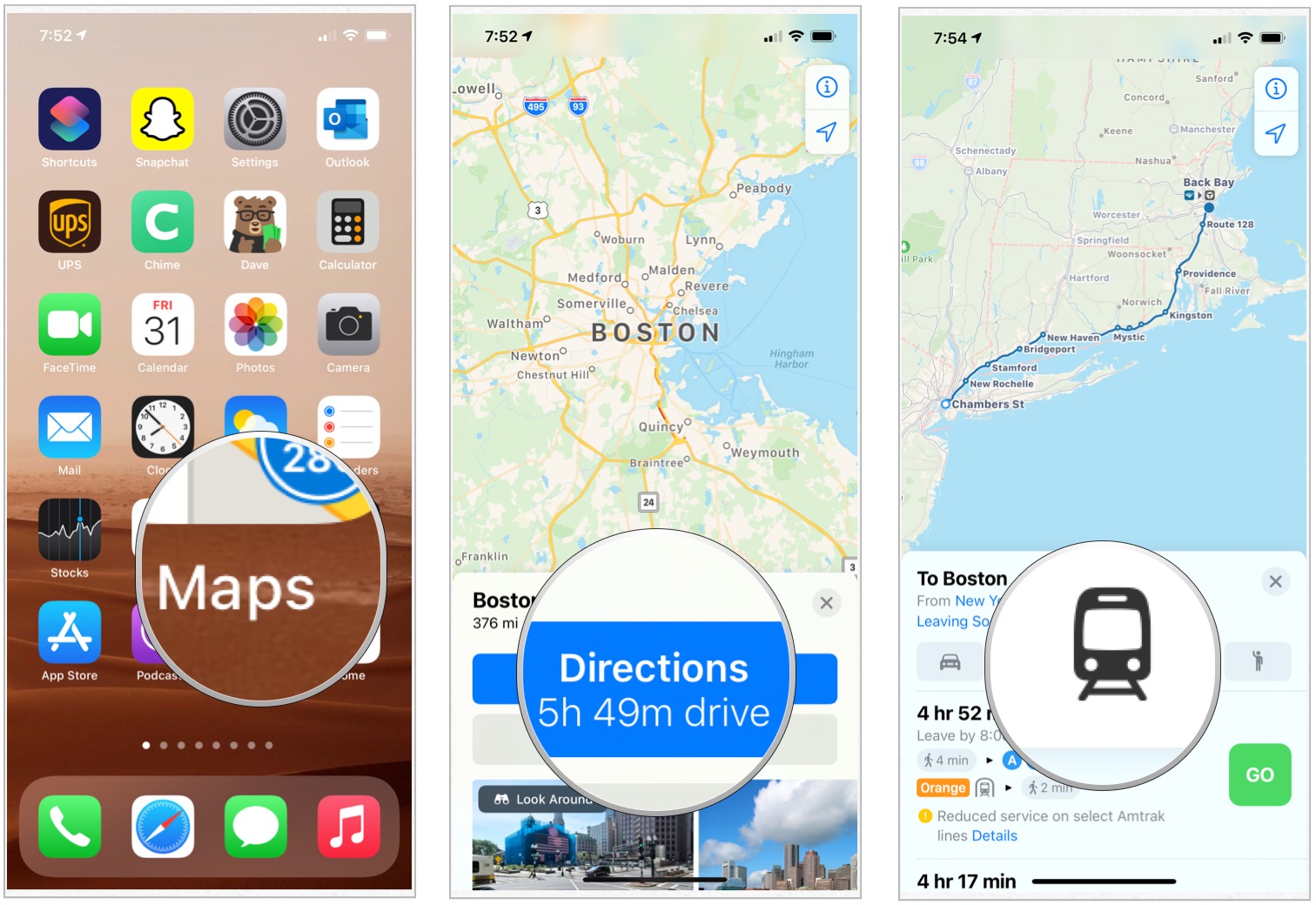
- Launch Maps from your Home screen.
- Pull up the directions you want for the destination you're going to.
- Tap Transit mode icon.
Choose Go to select your path among the choices.
- Tap a stop on the selected transit line.
- Tap the stop name that pops up.
Scroll down to see other transportation activity at that same stop.
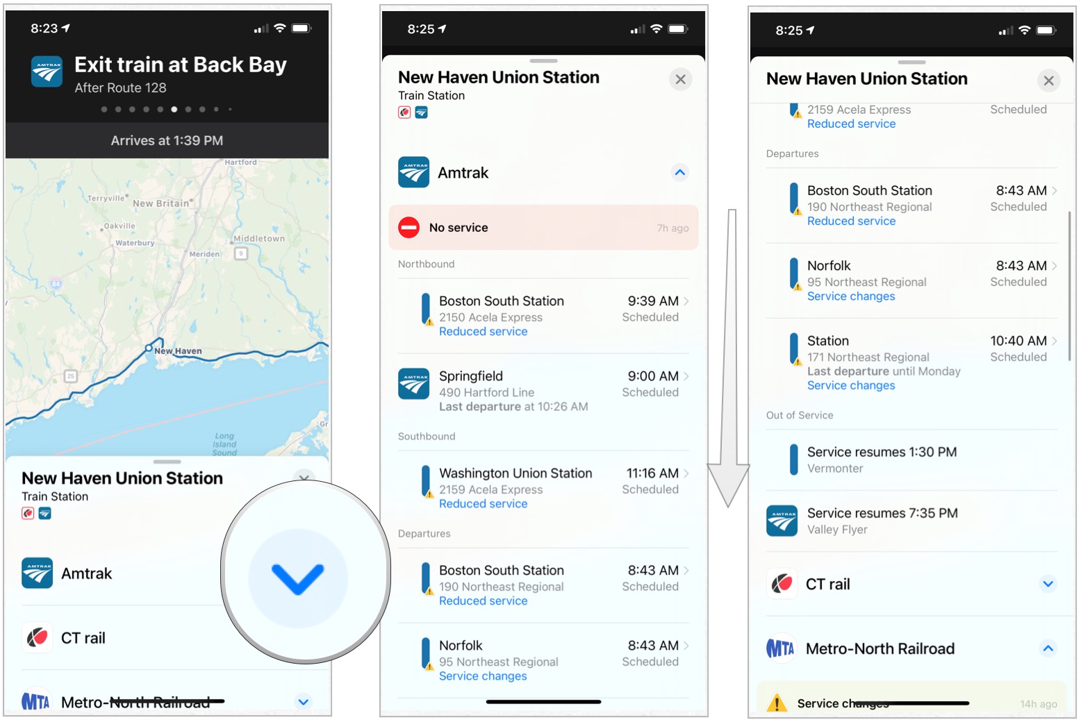
You can also see the next three scheduled arrival times and how often the transit line runs.
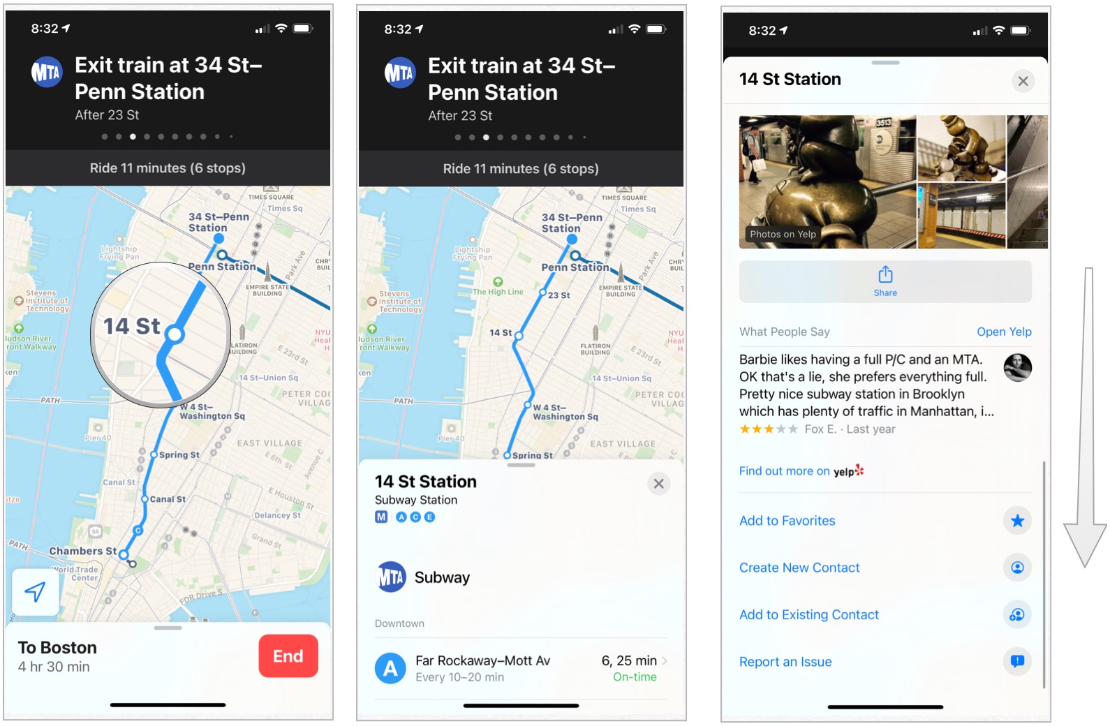
How to see what others are saying about a particular stop on a transit line in Apple Maps
If you're in an unfamiliar city taking public transportation, you might be worried about whether certain stops are populated with riff-raff. You can find reviews of many major transit stops from commuters who have been there before. Apple Maps incorporates basic information, as well as reviews and pictures from Yelp, right into the app.
- Launch Maps from your Home screen.
- Pull up the directions you want for the destination you're going to.
- Tap Transit mode icon.
Choose Go to select your path among the choices.
- Tap a stop on the selected transit line.
- Tap the stop name that pops up.
Scroll down until you see the photos, Wikipedia entry, and Yelp reviews.
How to filter transit directions by type in Apple Maps
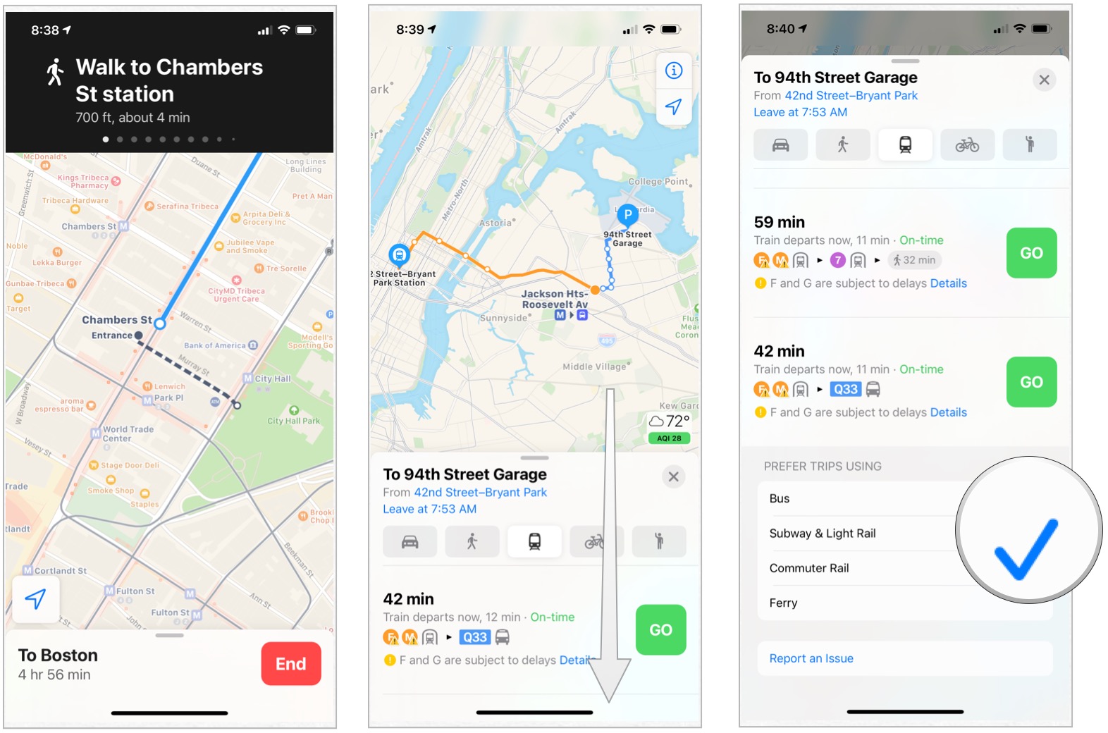
You may be a boss when it comes to taking the subway, but feel like a fish out of water when you step on a bus. In major cities, you are lucky enough to have many options for public transportation and can filter your route based on your preferred method of travel in Apple Maps. Depending on available options, you can filter by bus, train, subway, and ferry.
- Launch Maps from your Home screen.
- Pull up the directions you want for the destination you're going to.
- Tap Transit mode icon.
Choose Go to select your path among the choices.
- Drag the transit directions card up from the bottom of the screen.
- Scroll all the way to the bottom of the transit directions card and tap Prefer Trips Using.
Tap a transit vehicle to filter it out of the route suggestion results.
What's coming?
Apple occasionally offers updates to iOS, iPadOS, watchOS, tvOS, and macOS as closed developer previews or public betas. While the betas contain new features, they also contain pre-release bugs that can prevent the normal use of your iPhone, iPad, Apple Watch, Apple TV, or Mac, and are not intended for everyday use on a primary device. That's why we strongly recommend staying away from developer previews unless you need them for software development, and using the public betas with caution. If you depend on your devices, wait for the final release.
Changes are coming to the Maps app in iOS 14 and iPadOS 14. These include the introduction of cycling directions that will consist of bike lanes, paths, and roads. Electric vehicle routing is also incoming.
Apple also plans on introducing expanding travel guides in the new software releases. The guides will automatically update when new places get added.
Anything else?
Do you have any questions about viewing alternate transit lines in Apple Maps? Let us know in the comments.
Updated July 2020: Updated for iOS 13 and added information about what's coming in iOS 14.
Maps for iPhone and iPad
- What's new in the Maps app
- How to find locations and get directions with Maps
- How to share location and directions with Maps
- How to delete your search history and prior destinations in Maps
- How to use Siri with Maps
- How to enable and use Maps extensions
- Best Maps app extensions
- How to change settings for Maps
- How to report a problem in Maps
- How to use Maps with CarPlay